|
History
Klingle Road has been a public
roadway since 1839 (formerly known as Klingle Ford Road),
since before most of Woodley Park and Cleveland Park were developed.
In 1885, the Klingle Road right of way was
dedicated to the City for the purpose of staying a road "forever".
Klingle Road was used for logging
and by farmers since well before the creation of Rock Creek Park in
1880.
When Rock Creek Park was established, only three country lanes, Klingle,
Pierce Mill, and Military Roads had through connections on either side
of the valley above the National Zoological Park. These roads and
the major north-south routes on the eastern and western edges of what
became Rock Creek Park, such as Fourteenth Street, Broad Branch, and
Daniel's (today Oregon Avenue) Roads, largely determined the development
of the land area into the twentieth century.
Klingle Road was dedicated as a
public highway under D.C. Code, Title 7, Chap. 1, 7-104.
Klingle Road was used by farmers
for decades until just before World War I to bring grain to Pierce
Mill.
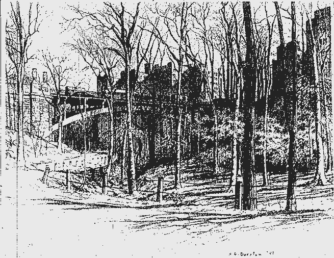
Klingle Road connects the Mt.
Pleasant Historic District (National Register of Historical Places No.
87001726) to the Old Woodley Park Historic District (Reg. No.
90000856).
Klingle Road is associated with
the Klingle Mansion (3545 Williamsburg Lane, NW.) which also is listed
on the National Register of Historical Places (No. 73000223) along
with the Causeway at 3029 Klingle Road (No. 90000910).
Mt. Pleasant residents from the
early 1900's on used Klingle Road for quick, easy access to the new
neighborhoods to the west and to the National Cathedral, Glover Park,
Burleith, Georgetown, and northbound Massachusetts Avenue to Ward
Circle, until it was made impassable by neglect in 1991.
In 1913 the city generated a plan
to straighten and widen the street as Klingle Parkway, connecting
Beach Drive and Reno Road.
"The dominant consideration, never to be subordinated to any
other purpose
in dealing with Rock Creek Park, is the permanent preservation of its
wonderful
natural beauty, and the making of that beauty accessible to people."
Olmsted
In 1901, the District of Columbia recorded a permanent system of
highways and incorporated these designations as part of a highway plan
within the DC Code. By law, all spaces on any duly recorded plat,
designated as a street or road became a "public way", if it
were recorded as such in 1901. Klingle Road was recorded in 1885 as a
public road with the DC Recorder of Deeds and became a part of the DC's
permanent system of roads.
In addition to being a DC public road, Klingle Road has federal
significance. Klingle Road is referenced as the historic southern border
for Rock Creek Park, the 1,754.62 acre parcel legally defined as
Reservation 339. The park's boundaries are roughly defined as Sixteenth
Street on the east, Oregon Avenue and Branch Road on the west, the
District line and Parkside Drive on the north and Klingle Road on the
south. A bill establishing Rock Creek Park was approved by both houses
of Congress and signed into law by President Benjamin Harrison on
September 27, 1890, five years after Klingle Road was land-dedicated to the
District of Columbia for use as a public highway. Klingle Road functions
as a public access road for Rock Creek Park, which is located in the
northwest quadrant of Washington, D.C.
Rock Creek Park retains a high degree of integrity that well reflects
the development of this public landscape between 1791 and 1941.In 1917,
the Board of Control commissioned the firm of Frederick Law Olmsted,
Jr., and his half-brother John C. Olmsted to prepare a planning study
for the future development of Rock Creek Park. The resulting report,
completed in 1918, became the seminal planning document for the planning
and expansion of Rock Creek Park. Its first sentence boldly declared the
credo that "The dominant consideration, never to be subordinated to
any other purpose in dealing with Rock Creek Park, is the permanent
preservation of its wonderful natural beauty, and the making of that
beauty accessible to people without spoiling the scenery in the
process." The Olmsted Plan for Rock Creek Park was adopted in 1919
and has remained a vital management document ever since. Certain roads
were designated for vehicular use. Klingle Road, although not a part of
Rock Creek Park, has served DC historically as a public road that
provides public vehicular access to this urban treasure, Rock Creek
Park.
The road network was a popular addition to the park because it opened
the valley to scenic carriage and automobile rides in most seasons,
particularly south of Military Road. Opening the park to vehicular
traffic provided increased public access on both sides of Rock Creek
Park. The present road system continues to reflect their original
purpose of providing public access to the enjoyment of extraordinary
rural scenery. A comparison of a 1918 Olmsted Plan Map, a National Park
Service annotated version of that base map prepared in 1941 indicating
road conditions in the park, and a modern topography map prepared in
1989, illustrated that the alignment and width of the roads has not
changed significantly since 1941. Similarly a comparison of a 1933 map
of Rock Creek's facilities reveals that the reservation has retained a
high degree of its historic integrity. Although adapted to the
automobile, the designed alignment, width and the environmental
surroundings of these scenic roads has not substantially changed since
the 1920's. According to the 1985 Rock Creek management plan, the road
system is 18.79 miles long and the standard width of roadway is 20 feet.
A major non-historic addition to the trail system of the park was the
paving of bicycle routes in the 1960s and 1970s.
In addition, the roads serve as connectors to some of Washington's
architecture on both sides of Rock Creek Park. For example, the Tiger
Bridge can be seen from the Piney Branch Parkway, which is walking
distance to Klingle Road and a connector for Mount Pleasant and the
adjacent neighborhoods of Crestwood and Rock Creek East. The Bridge
appears as a solid arch. This Sixteenth Street Bridge was built in two
stages between 1907 and 1910 and was the first parabolic arch bridge
built in the United States. The topside of the bridge on Sixteenth
Street incorporates simple neoclassical balusters and dramatic tigers,
sculptured by noted animalier Alexander P. Proctor, which flank each end
of the bridge and lend the bridge its popular name, "Tiger
Bridge."
For these and many other reasons, the establishment of Rock Creek
Park proved to be vital to the future development of the national
capital. The fight to establish the park united a body of civic-minded
businessmen dedicated to the city's economic improvement and residential
desirability. The effort to preserve the historic function of Klingle
Road and access to Rock Creek Park is uniting a similar fervor and
probably for the same reasons. That same attitude of the businessmen who
fought for Rock Creek Park and for public access will be needed today to
ensure that the historic functions that the roads have served will
continue to benefit future generations. Hopefully, 100 years from today,
the roads and trails of Rock Creek Park will continue to form a
historically significant circulation system that contribute a
distinctive layered historic character to the park.
Klingle Road remains listed as an arterial roadway for vehicular
traffic on the District of Columbia's Functional Classification Map and
is a part of DC's permanent system of highways. Klingle Road remains a
right-of-way on the federal-aid system and has not been officially or
administratively closed. It is imperative that DC preserve the historic
function of Klingle Road and maintain the public access that the
planners intended with regard to Rock Creek Park, as well as the
function that the road serves as a connector for DC residents.
|